|
|
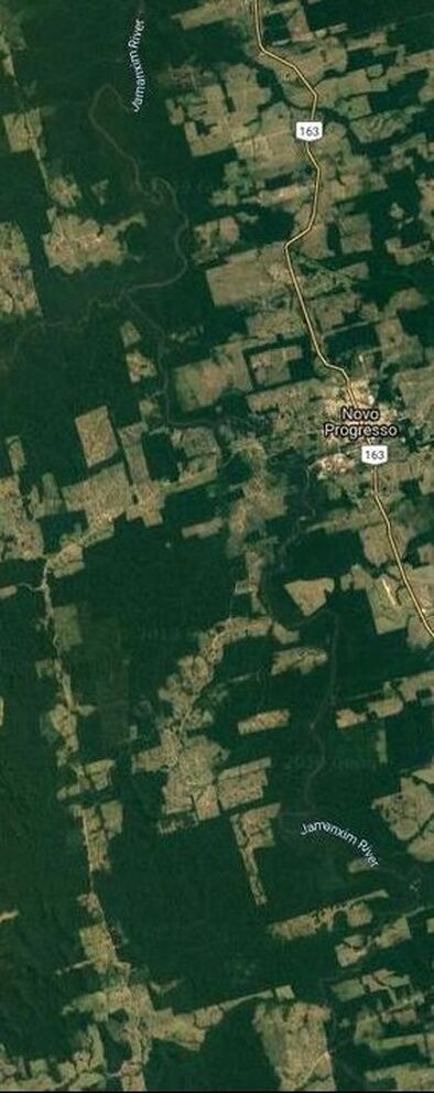
Satellite imagery showing deforestation near Jamanxim National Forest, Brazil (Google Maps 2019)
|
The Amazon forest faces escalating anthropogenic pressure. Deforestation in the Amazon basin has increased by over 25% for the second year in a row, imperiling biodiversity and the livelihoods of the many communities who live there.
By bringing together interdisciplinary methods, we seek to understand the drivers and solutions that shape deforestation. This project integrates insights from critical conservation studies and land system science to examine the interaction between agricultural expansion and conservation in the Amazon basin. Our research focuses on 3 protected areas in Bolivia, Brazil and Peru where rapid agricultural expansion is encroaching on areas designated for the conservation of natural biodiversity and local livelihoods. Through an analysis of forest change data, we will identify where deforestation due to agricultural expansion has recently occurred in conservation areas or areas identified as priorities for future conservation. We will use remote sensing to create a time series of deforestation and characterize areas of agricultural infringement. Building on this analysis, we will produce an iterative, probabilistic land use change model to identify areas at risk of future deforestation. Discourse and policy analysis conducted for the case study sites enable us to better choose model variables and interpret model results. Our research questions include:
We will share our findings through a variety of mediums. We will create interactive online story maps as tools for conservation advocacy and public engagement, three peer-reviewed academic articles, and a short multilingual policy brief to inform policy and decision-making. |
Acknowledgements
Our collaboration is funded by the National Socio-Environmental Synthesis Center (SESYNC).
