Land Use Change Modeling in R
We are producing iterative, probabilistic land use change models using R to identify areas at risk of future deforestation based on diverse drivers and proposed solutions. This component integrates findings from both remote sensing and the qualitative analysis.
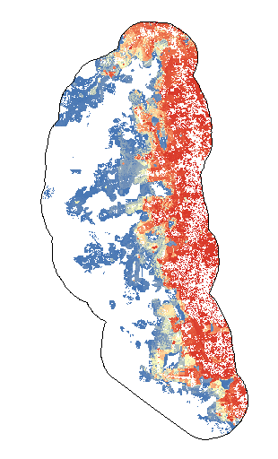
Probability of deforestation in and around Jamanxim National Forest, Brazil.
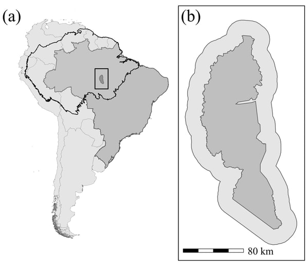
Figure 1. Study site in (a) South America (black outline, Amazon Basin; dark gray, Brazil) and (b) Jamanxim National Forest (dark gray) with a 20-km area around it in lighter gray
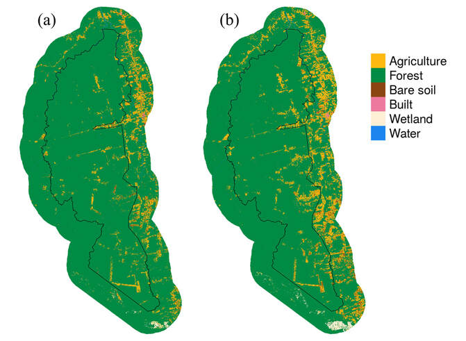
Figure 2. Land cover in (a) 2008 and (b) 2018 in Jamanxim National Forest and a 20-km area surrounding the national forest (black line, national forest boundary)
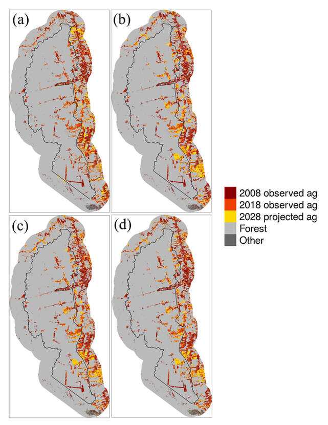
Figure 3. Forest conversion to agriculture observed from 2008 to 2018 and projected conversion to agriculture in and near Jamanxim National Forest based on the (a) land-use change (LUC) model, (b) discourse analysis (DA) model, (c) LUC and DA model, and (d) refined LUC and DA model (ag, agriculture; yellow, projections based on the 4 different models; black line, national forest boundary)
