Classified Land Cover Analysis
|
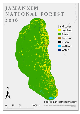
We are using remote sensing to create a time series of deforestation and characterize areas of agricultural infringement across our three protected areas of interest. For this part of our analysis we are using both GeoSurvey and Google Earth Engine.
|
|
